

Mottaret, France | FreeRide Sector: Roc de Tougne
Ride Date:
28 Feb 25Snow conditions:
VariableAvalanche level:
3 - ConsiderableTerrain:
Side countryWeather conditions:
SunnyPrecipitation:
ClearElevation entry point:
2500mElevation exit point:
2100mAspect:
North EastMax slope angle:
Between 30 and 45 degreesDrop in:
Ridge DropExit:
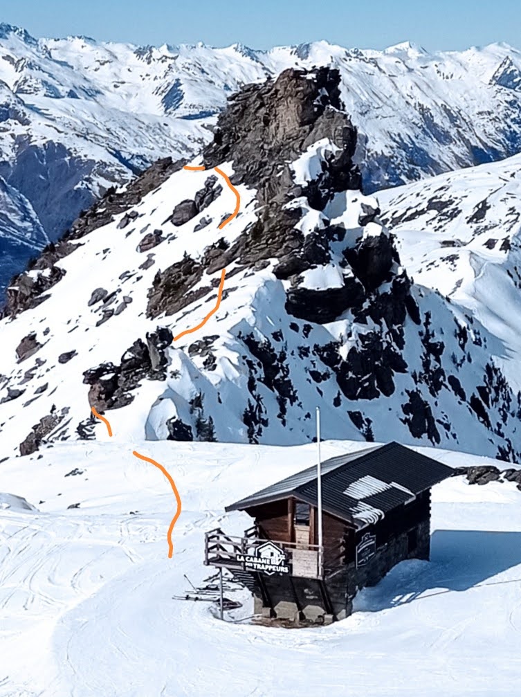
Ski out400m of vertical descent from one of the most iconic features in the Meribel-Mottaret valley.
Don’t attempt this line without carefully scoping it first. This can be done from the top of the Combes 2 Chairlift in Mottaret. It’s still some distance away so binoculars or a camera with a good zoom will be useful. Once you have located the ridge and decided on your line, head up the Roc Du Tougne chairlift to the Trappeurs Hut (a FreeRide Republic favourite lunch spot). Your journey starts here by contouring around the west side of the Roc du Tougne in a northerly direction (see photos). This will most likely be a combination of traversing, side-stepping and booting. At the northern end of the feature, in an interesting little gap between two rock faces, there is a short down climb (see photo) onto the ridge from which you will drop. The bottom of the Roc du Tougne chairlift some 400m below is the exit point.
You will need a backpack with ski carry to successfully negotiate the down climb. A helmet is also a good idea. There is a via ferrata cable at points along the route which could also be employed with a harness and carabina.
There is some work involved accessing this line which makes it all the sweeter. It also means it often gets overlooked which only increases your chances of being first in.
Getting to the ridge requires care as does finding a good spot from which to drop – both of which push the gnar to the higher end of the scale.
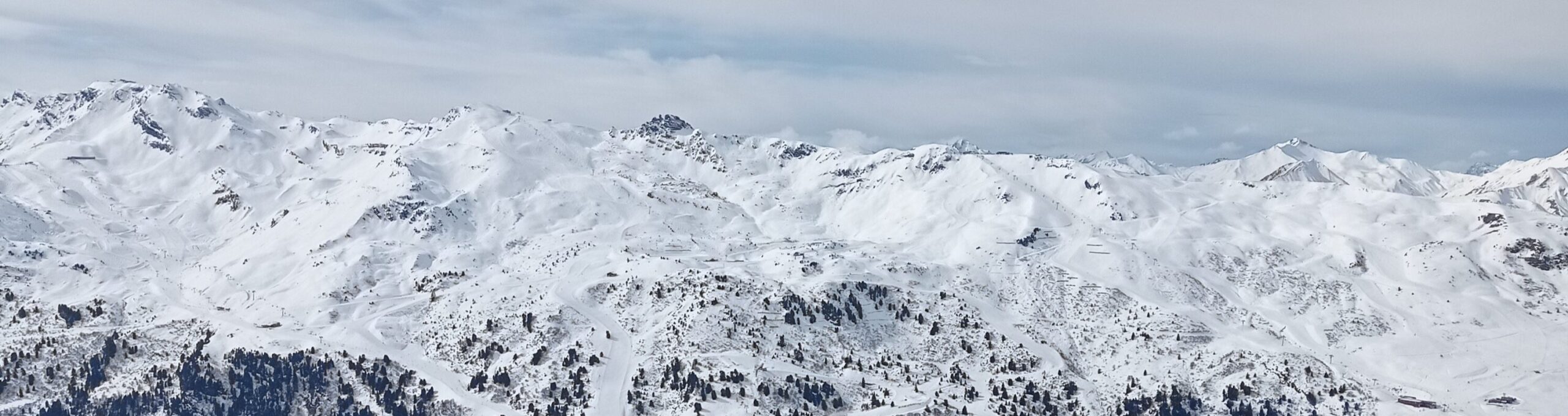
The Roc du Tougne is one of the most awe inspiring features in the Meribel – Mottaret valley. Getting up this close and personal will leave memories to savour.
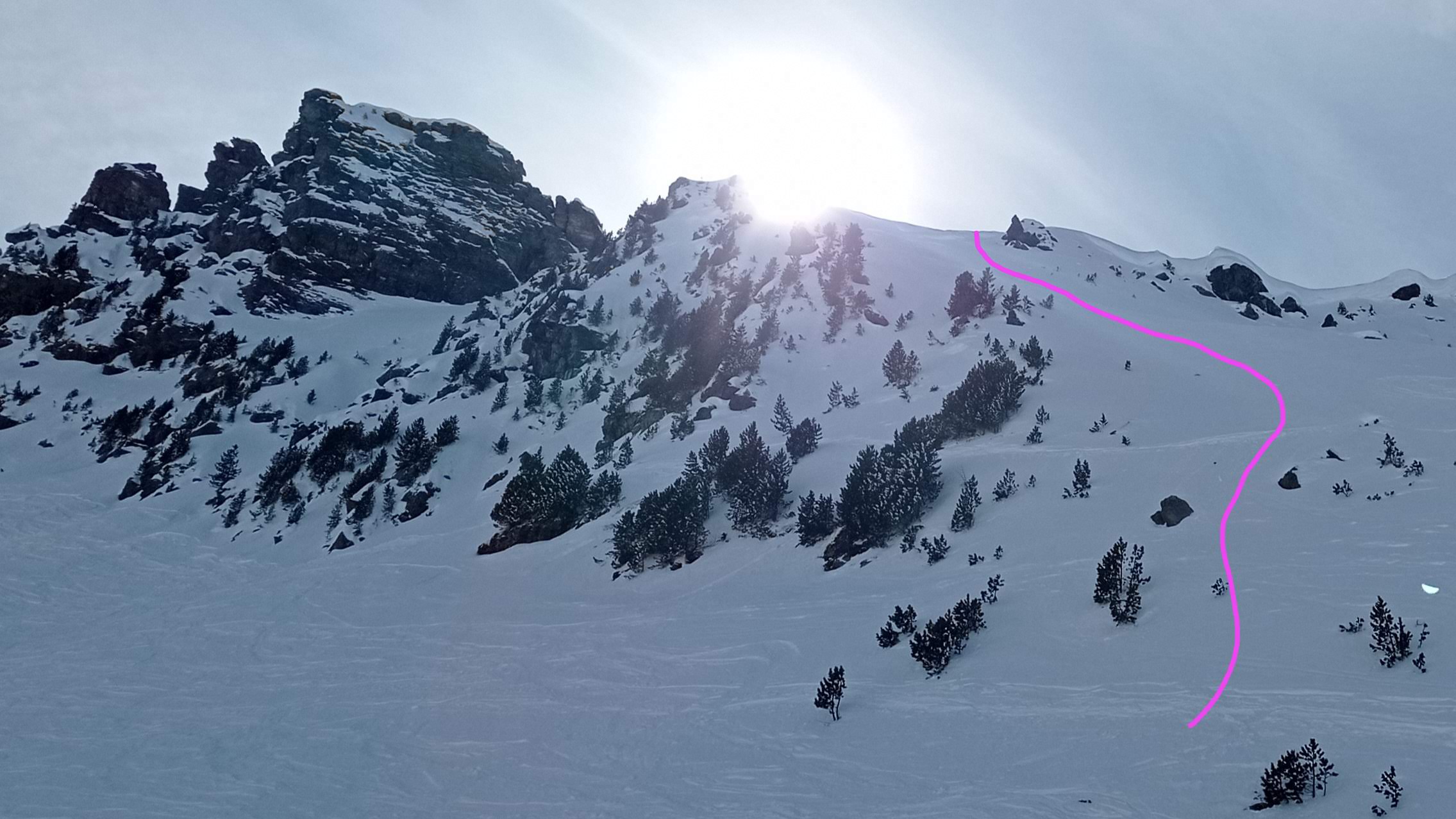
The route from the Trappeurs Hut along the western side of the Roc.
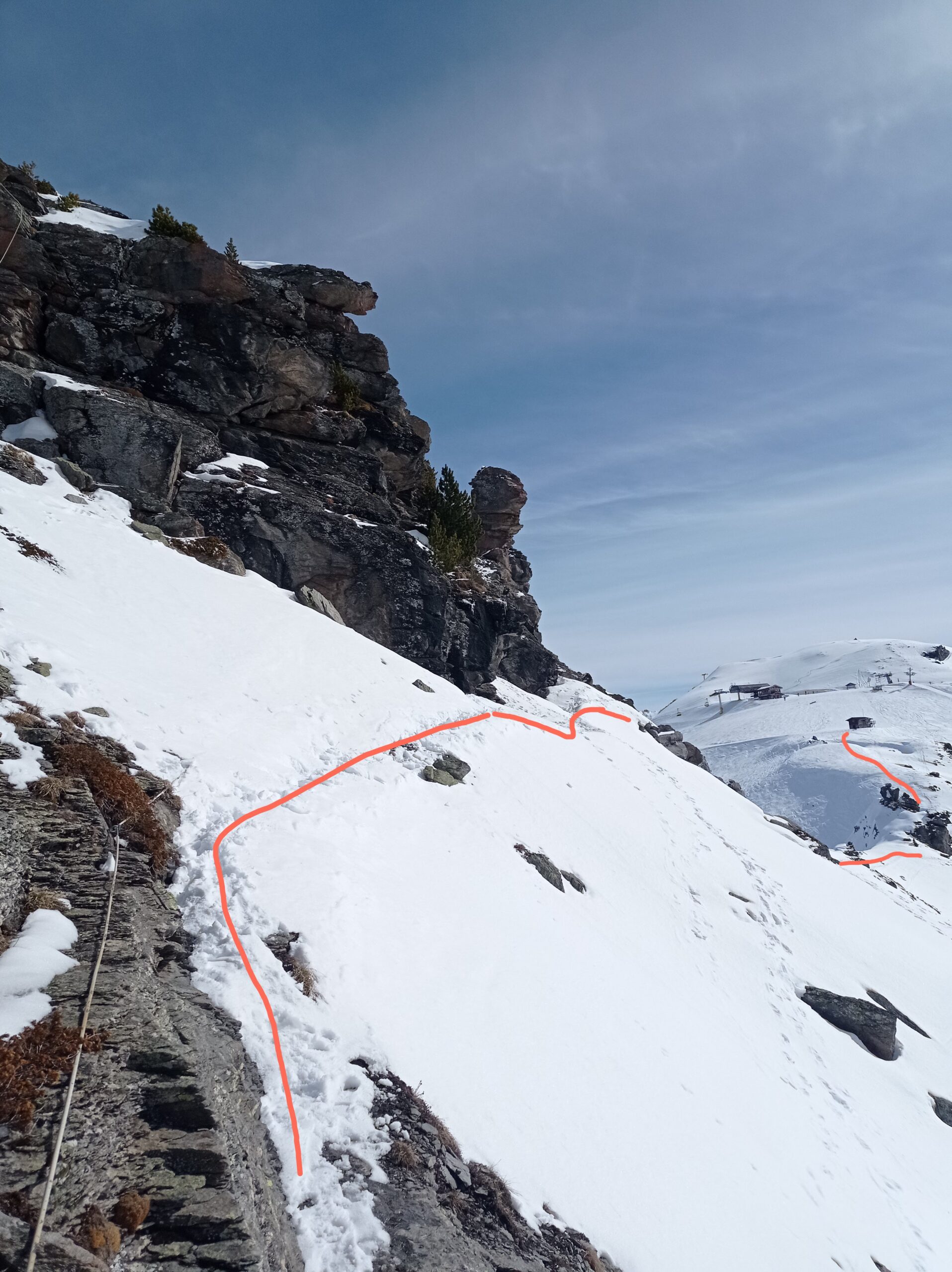
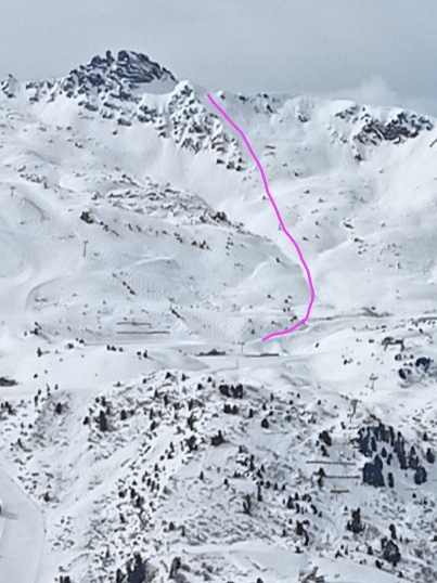
The same traverse viewed from the northern end. The Trappeurs Hut can be seen in the distance. The via ferrata line is also visible in the foreground on the left.
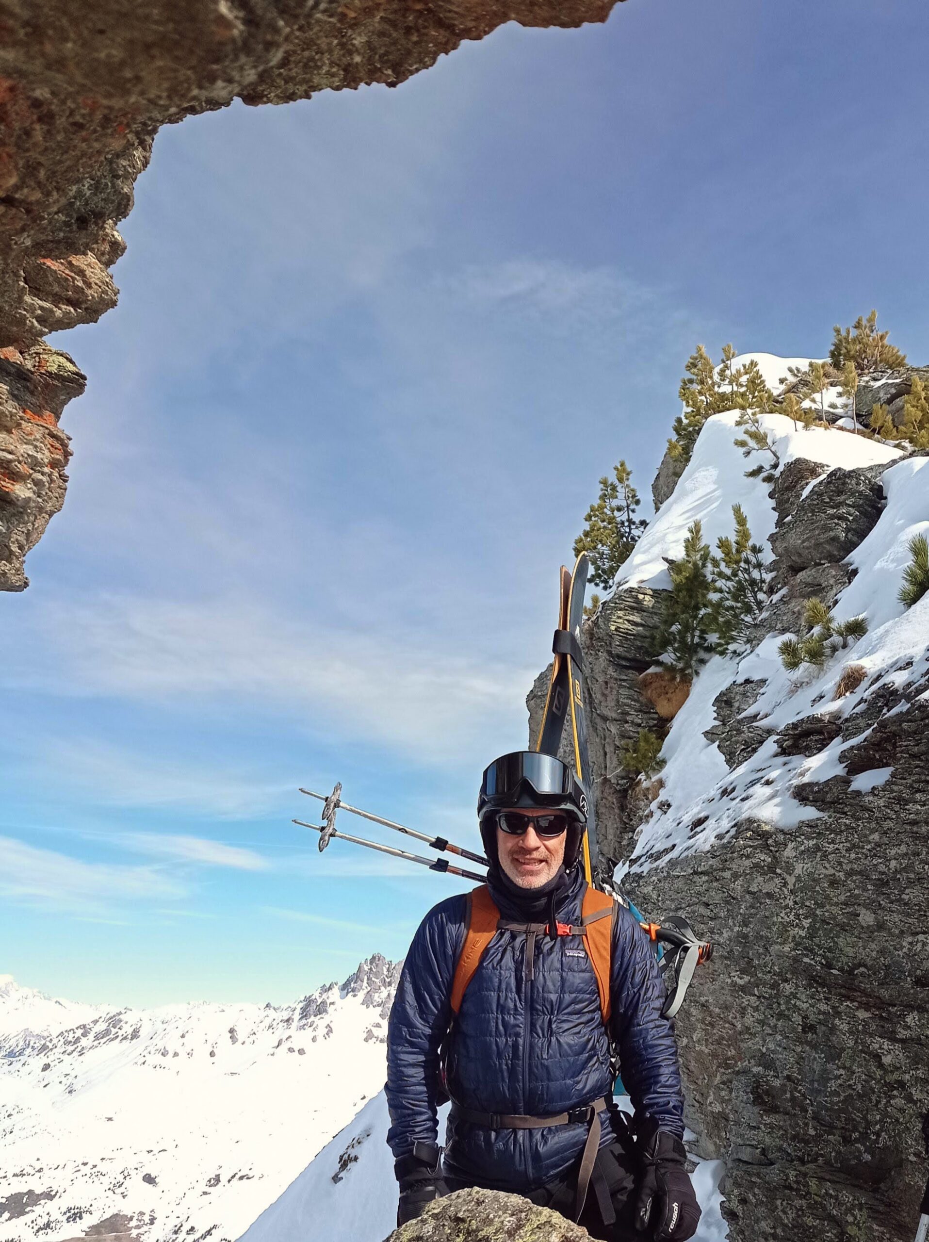
The gap from which you will start your downclimb. ⛷️ Goodshitskier.
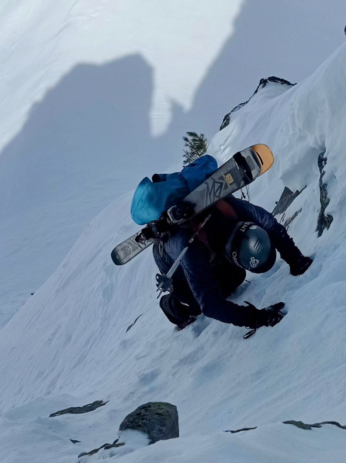
The down climb onto the ridge. ⛷️ Goodshitskier.
The NE side of the ridge.
400m of vertical descent to get your stoke flowing.
Explore the themes below to find the best home for the content you want to learn about:
Great little adventure. Ice would have come in handy to make the down climb feel a little more secure.
I guess you mean ice axe? Good call. Some crampons too if it’s icy.
I headed up the Roc du Tougne by the same route on 15/01/26 but skied the SW face instead. Not as steep, gnarly or as many turns as the NE face but plenty of sun exposure gave me the confidence to ski this side of the ridge on ava 4/5. It was bliss and the hike in exactly as described by Crazy Hors above – the photos really helped too (thanks buddy).